2016-09-29
Environmental Engineering (Polluted site management)
- Client: A multinational of the chemical industry
- Project manager: Ingerop consulting and engineering
- Completion date: 2011-2012
PROJECT DESCRIPTION AND CHARACTERISTICS
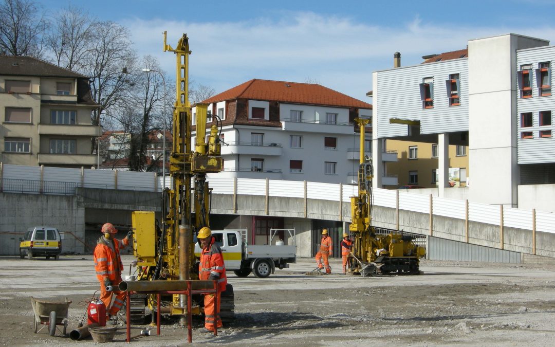
Project to rehabilitate a 4ha land, polluted to a large extent by chlorinated pesticides produced and buried on site between 1950 and 1970.
ASSIGNMENT
- Brief historical investigation and development of a technical investigation program to assess location and volumes of pollutants. Elaboration of tendering documents for investigation drillings.
- Monitoring and geological description of 74 drill holes (Depth of 6 to 12 meters) and 10 excavations trenches. Instructions for soil sampling (280 samples). Coordination of companies, compliance assessment for Health and Safety requirements.
- results interpretation, estimation of polluted material volumes. Drafting of a synthesis report and a remediation project. Evaluation of the proposals of services for the remediation works.
2016-09-27
Dams and hydraulic Engineering (Flooding management)
- Client: Japan International Cooperation Agency (JICA) and Ministry of Agriculture and Water Resources (MARH) of Tunisia
- Assignment: Across the watershed: Hydrological and hydraulic studies; Optimization of the operation of flood control dams in catchment area / In zone D2 (lower valley of the Mejerda): Diagnosis, Study and Preliminary design: Design, dimensioning of flood protection structures; Design, dimensioning of the El Mabtouh flooding basin
- Total cost of the assignment: 400 kCHF
- Completion date: 2013-2014
PROJECT DESCRIPTION AND CHARACTERISTICS
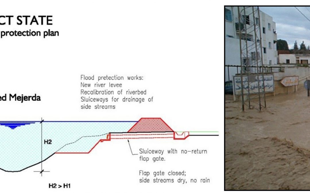
A “Master Plan for the Regulation of Flooding in the Medjerda River Basin” was developed within the framework of the Tunisian-Japanese Cooperation between 2006 and 2009, following the flood of 2003 which caused major damage. This master plan identified both structural and non-structural measures to prevent devastating flooding and to protect the population.
In order to implement the measures, the plan proposed, on the basis of protective measures and the level of development as well as the characteristics of the floods, a subdivision of the watershed of the Oued Medjerda, which covers an area of approximately 16,000 Km² in Tunisia, in four zones, two zones upstream of the Sidi Salem dam and two downstream, including zone D2.
The objective of the Integrated Management and Flood Control Project in the Mejerda Basin is to limit the damage caused by floods in the lower Oued, where so far most damage occurred. Due to improvement of the wadi and of dams, and also through training of the local personnel responsible for the system and through preparation of local population for the floods, this risk reduction will contribute to the economic and industrial development of Tunisia.
Oued Mejerda, 312km long, is the only perennial river in the country. Its basin, which covers a total area of 23,700 km² (of which 1/3 is in Algeria), is located in northern regions where precipitation is relatively high. It is a particularly important source of water for Tunisia.
The country has focused its water resource management policy on retention. To this end, it has developed a vast complex of 27 reservoir dams in the northern part of the country, 13 of which are in the planning or construction phase. Until now, the management of dams has been orientated more towards retention of maximum volume of water than prevention of damages caused by the floods.
However, the dams play an essential role in protecting against the Mejerda floods. In order to optimize the drainage capacity of the whole device, it is necessary to know about a flood in advance to proceed with a preventive lowering of levels of reservoirs.
The volume of the floods is then contained by the dams that control the flows released to prevent downstream flooding while preserving as much water as possible.
As a non-structural measure, a model concept for flood forecasting and management was proposed. The aim is to equip operators of the dams with a decision-making tool. The “MINERVE” system, developed in the context of flood management in the Rhône-Alpes basin with the optimization of hydroelectric production, is an example of functionality of such a tool.
The general principle of operation is shown in the diagram below. The system input data is meteorological forecasts, real-time rainfall and flow measurements, and rainfall and flows recorded in a database. On the basis of these elements, the hydrological forecast model simulates the hydrographic network response to a rain event. The results of modeling are the forecasts of the flows at critical points with possible scenarios. The proposed system allows decision makers to have an overview of evolution of flows in the network and to take appropriate measures accordingly.
ASSIGNMENT
GEOS’s missions consisted of several studies on flood control related in particular in the following subjects:
- Implementation of a hydrological model and management of MIKE BASIN watershed for the Mejerda catchment.
- Hydraulic modeling MIKE FLOOD on a 60 km section, in zone D2 according to the master plan.
- Optimization of the functioning of existing and future dams (horizon 2030) for flooding. Establishment of the basics for flood forecasting model at the watershed scale.
- Design of hydraulic structures (zone D2): dykes, 50 000 m³ flood-clearing basin, meandering resurfacing.
2016-09-27
Dams and hydraulic Engineering (Hydraulic modeling)
- Client: Geneva Airport, East Wing Project – Service Buildings
- Assignment: Complete mandate SIA 103 (Swiss Standard)
- Total cost of work: CHF 3 million
- Total cost of the assignment: 745 kCHF
- Completion date: 2012-2013
PROJECT DESCRIPTION AND CHARACTERISTICS
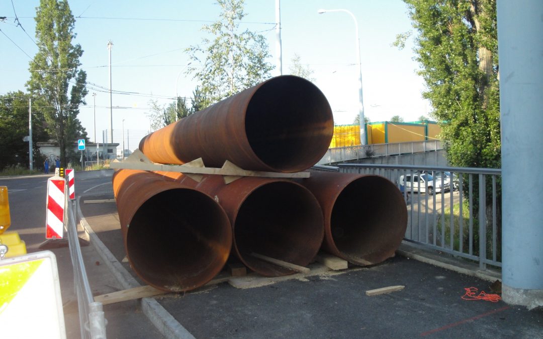
The preparatory work to build the East Wing of the Geneva Airport consists of adapting the existing diverse networks and, above all, moving an oil separator located in the right-of-way of the future building. The new pipelines construction required the use of the microtunneler technique to allow the passage under existing structures (technical galleries, oil separator) and minimize the impact on the airport operation.
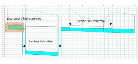
A comprehensive hydraulic study was carried out in order to study flow conditions in the sewerage network of the 2nd Zone of the Airport, incorporating modifications made during the preparatory work. This project was modeled on MOUSE within the framework of the airport water management plan. This model highlighted a major dysfunction: a general under capacity of the current network.
Characteristics of the hydrodynamic model:
- Catchment area: 11.2 ha
- Number of manholes: 440 manholes
- Network length: 40 km
- Rainfall: 10 years multi-peaks with peak intensity of 138 mm / h
- Modeled special networks: 2 weirs, siphon system, storage mode, retention basin, oil separator regulating valve.
Technical characteristics of the pipelines made by microtunnel boring machine:
| Microtunnel n°1 |
Microtunnel n°2 |
– Length: 40 m
– Pipes diameter: 1,200/1,490 mm
– Slope: 1%
– Land crossed: moraine wurmienne
|
– Length: 37 m
– Pipes diameter: 1,000/1,280 mm
– Slope: 0,5%
– Land crossed: moraine wurmienne |
|
ASSIGNMENT
Realization of the complete services under SIA 103 (Swiss Standard) including proposed work, call for tender, execution project, works management, commissioning and completion.
2016-09-27
Dams and hydraulic Engineering (Networks)
- Client: Town of Lancy, Construction and construction services (GE, Switzerland)
- Assignment: complete mandate SIA 103 (Swiss Standard)
- Total cost of work: 1,085 kCHF Including VAT
- Total cost of the assignment: 53.5 kCHF Including VAT
- Completion date: 2010
PROJECT DESCRIPTION AND CHARACTERISTICS
The project consists of the separation of the drainage network of Bac road.
Technical characteristics of the project:
- Installation of EU (waste water) / EC (clear water) networks in common excavation (EU Ø 300 mm, EC Ø 500 mm, L = 120 m)
- Installation of an EC network in a tube push under the Carrefour Bac road / Communes Réunies avenue (EC Ø 700 mm, L = 50 m)
- Laying of EC network in single excavation (EC Ø 700-800 mm, L = 130 m)
- Tubing of the existing EM pipes (EU Ø 300 mm, L = 135 m)
- Work in the Public Transport Genevois TPG
ASSIGNMENT
Realization of the complete services under the SIA 103 (Swiss Standard) including the proposed work, call for tender, execution project, works management, commissioning and completion.
2016-09-27
Dams and hydraulic Engineering (Stormwater management)
- Client: Onex Commune – Public Infrastructure and Environment Department
- Assignment: Complete mandate SIA 103 (Swiss Standard)
- Total cost of work: 800k CHF
- Total cost of the assignment: 93k CHF
- Completion date: 2013
PROJECT DESCRIPTION AND CHARACTERISTICS
The project consists of:
- The development of a master plan for stormwater pipes for the area, located between the Pré-Longet road and the Mouilles road, to the point of connection to the communal network.
- Control of flows of the return flow of unpolluted water according to the master plan of water evacuation for communes Onex and Lancy.
- Design and complete project management of a retention bassin and a sewerage network.
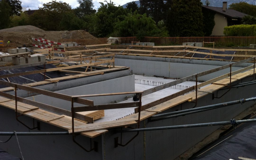
TECHNICAL CHARACTERISTICS OF THE PROJECT
- Reinforced concrete hydraulic structure (pre-walls – pre-slabs)
- Bassin area: 205 m²
- Bassin volume: 495 m³
- Effective retention volume: 100 m³
- Separation networks in common excavation (EC Ø 400 mm, EU Ø 315 mm)
- Non-return valve at the outlet of the bassin
ASSIGNMENT
Realization of the complete services under the SIA 103 (Swiss Standard) including the proposed works, call for tender, execution project, works management, commissioning and completion.