27 juillet 2023
Geotechnical engineering
- Project Owner : RFF
- Project management : INGEROP
- Mission : Assistance au Maître d’Oeuvre
- Cost of the mission : 12 k€
- Mission date : 2010 2011 design – 2013-2014 works
BRIEF DESCRIPTION AND CHARACTERISTICS OF THE PROJECT
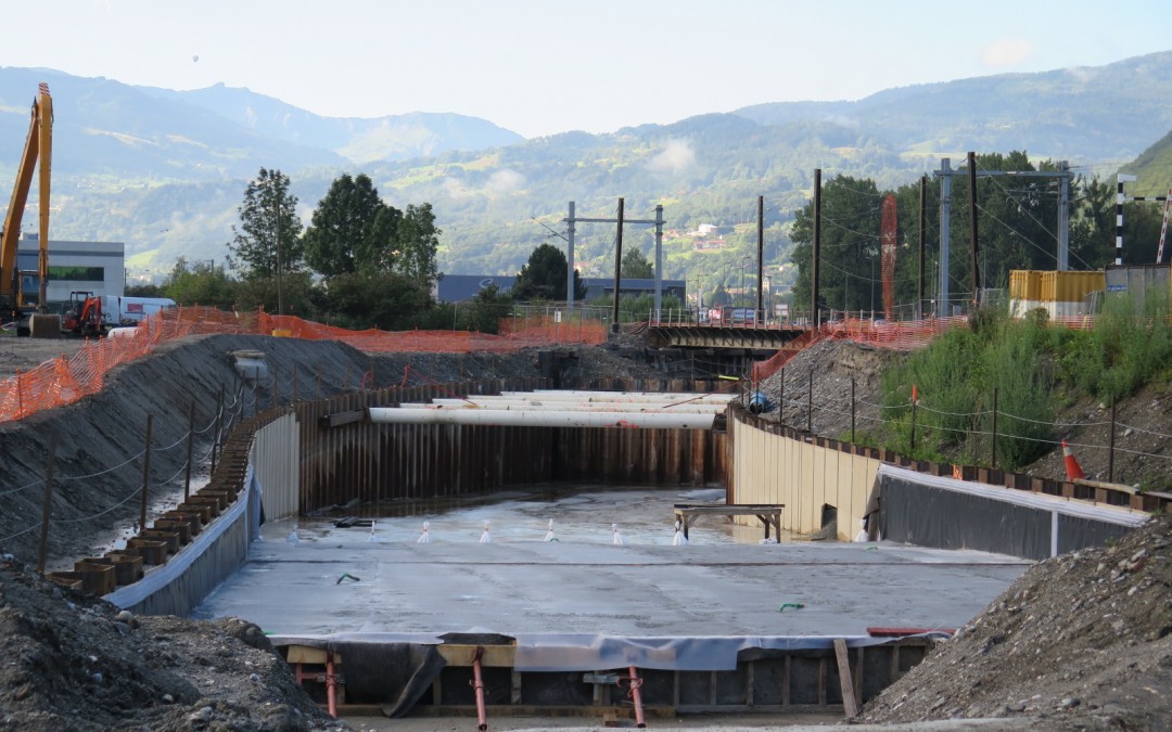
Level crossing 46 (PN 46) is located at the northern exit of the town of Sallanches, at the junction between the RD 1205 (formerly the RN 205) and the railway line linking La Roche sur Foron to Saint-Gervais les Bains.
It is one of the 400 NPs of concern identified by the Ministry of Public Works, RFF and SNCF at national level.
Under the chosen solution, the RD 1205 is diverted slightly and passes under the railway line via a hopper and a sloping underpass, joining the South roundabout.
The structure is 225 m long and around 15 m wide.
As the water table is shallow and the permeability of the ground is high (gravelly alluvium of the Arve), the structure requires the use of a temporary sheet-pile retaining structure, combined with a hydraulic plug at the bottom of the excavation. The final structure is an open concrete trench with a rail bridge in the middle.
MISSION
GEOS carried out a G5 geotechnical expertise and assistance assignment in accordance with standard NF P 94-500.
These studies covered the following points in particular:
- Definition of additional geotechnical and hydrogeological survey programmes;
- Assisting the project management team in managing the G2 mission, during the project phase, carried out by an external geotechnical engineering office.
27 juillet 2023
Geotechnical engineering
- Project Owner : ERE – EIFFAGE RAIL EXPRESS
- Project management : CLERE – CONCEPTION LIGNE EIFFAGE RAIL EXPRESS
- Mission : Mission G2 : Etude terrassements + fondations OA (conception) ; Mission G4
- Cost of the mission : 1 538 k€
- Mission date : 2011-2015
BRIEF DESCRIPTION AND CHARACTERISTICS OF THE PROJECT
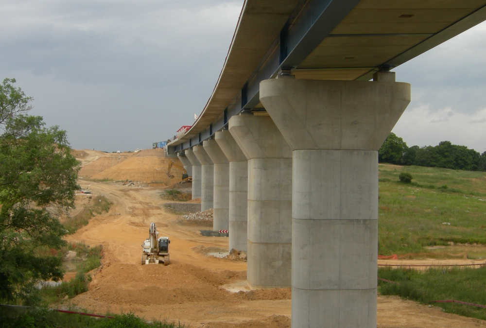
The Bretagne – Pays de la Loire high-speed line (LGV) is an extension of the LGV Atlantique Paris – Le Mans. It crosses the Brittany and Pays de la Loire regions and the departments of Sarthe, Mayenne and Ille et Vilaine.
The total length of the route is 182 km, plus 32 km of connections to the existing network.
As part of this project, GEOS worked on section B, which is 30 km long and runs from Laval to Vitré.
MISSION
GEOS carried out G2-AVP & PRO studies in the design phase. These studies cover
- definition, monitoring and supervision of geotechnical surveys ;
- earthworks (stability of earthworks, reuse/upgrading of materials, construction provisions, geotechnical models);
- standard engineering structures (type of foundations, construction provisions, etc.);
- the Vicoin causeway (a non-standard engineering structure comprising nine spans with a total length of 260 m).
The design assignment was supplemented by a G4 geotechnical supervision assignment covering the design supervision (VISA) and construction supervision (DET) phases.
27 juillet 2023
Geotechnical engineering
- Project Owner : AUTOROUTES DU SUD DE LA FRANCE
- Project management : INGEROP CONSEIL ET INGENIERIE
- Mission : geotechnical project management
- Cost of the mission : AVP/PRO : 552 k€ ; VISA/DET : 434 k€
- Mission date : 2006-2016
BRIEF DESCRIPTION AND CHARACTERISTICS OF THE PROJECT
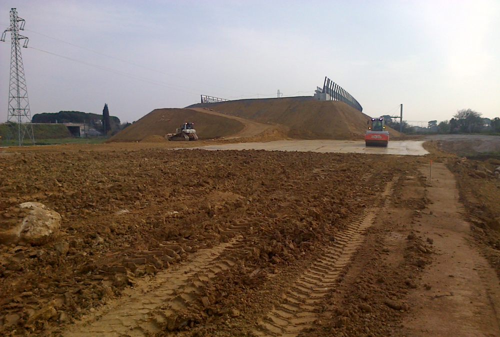
The study carried out by GEOS Ingénieurs Conseils is part of the project to relocate the A9 motorway in Montpellier.
Half of the 23 km route involves widening the existing motorway and the other half a new route.
In terms of earth movements, the route involves a deficit: 3.1 million m3 of backfill and 1.2 million m3 of excavation.
In the central part of the new route, the project crosses a vast plain of alluvial deposits (Lez-Lironde, Lantissargues, etc.) and comes into contact with the CNM TGV line currently under construction in a sector where compressible soils with a high degree of lateral variability have been identified.
The embankments, which are 6 to 12 metres high, were placed in advance to minimise their interaction with the CNM project. Vertical drains were installed under the most sensitive technical blocks.
MISSION
In collaboration with the engineering teams of INGEROP, the project manager, GEOS carried out the geotechnical design studies (Motorway Preliminary Design) and is monitoring the works (VISA, DET).
According to standard NFP 94-500, this involves the sequence of tasks G1-PGC/G2-AVP/G2-PRO/G2-DCE/ACT and G4. These studies covered the following points in particular:
- Definition of the geological, geotechnical and hydrogeological context of the project,
- Drafting of the geotechnical sections of the TCFH APA,
- AVP and PRO: Studies of earthworks (stability, slopes, settlement) and OA,
- Definition of comfort measures (masks in excavations, vertical drainage and preloading of technical blocks),
- Definition of the monitoring to be carried out,
- ACT: Technical assistance in drawing up the tender documents and analysing the bids,
- VISA of the geotechnical execution studies, approval sheets and execution procedures,
- DET: Geotechnical supervision of works.
27 juillet 2023
Geotechnical engineering
Tunnels and underground structures
- Project Owner : Groupement Local de Coopération Transfrontalière (G.L.C.T.)
- Mission : Maîtrise d’œuvre complète (AVP, PRO, ACT, VISA, DET, AOR)
- Cost of the mission : 463 k€ HT
- Mission date : 2006-2010
CHARACTERISTICS
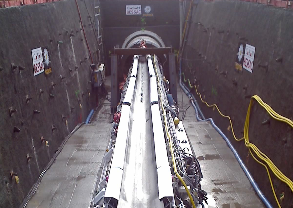
The project involves building a wastewater drainage tunnel between St Genis Pouilly in France and Choully in Switzerland.
The project comprises:
- a 3000 m long, Ø 2500 m east tunnel;
- 6 collectors Ø 1000 to 1500 with a total length of 778 m ;
- 4 access shafts.
MISSION
GEOS Ingénieurs Conseils carried out the complete project management mission as the lead contractor on behalf of the Groupement Local de Coopération Transfrontalière (G.L.C.T.).
These studies included the following services:
- Geotechnical monitoring, front-end surveys ;
- All the tasks required under the MOP law (AVP, PRO, ACT, DCE, VISA, DET);
- Project management, schedule management and binational aspects (customs, tax, environment, employment law, etc.).
27 juillet 2023
Geotechnical engineering
- Design and construction: Groupement VINCI
- Mission: G2-PRO & G3
- Cost of the mission: 90 k€
- Mission date: 2014-2015
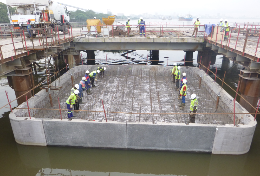
BRIEF DESCRIPTION AND CHARACTERISTICS OF THE PROJECT
The study carried out by GEOS is part of the project to build the second bridge over the Wouri River in Douala (Cameroon). It concerns the accesses to the structure, which are 700 m long on the right bank (Bonabéri) and 2,000 m long on the left bank (Deïdo). They support a road and a railway line. The longitudinal profile of the accesses is mainly embankment, up to 9 m high. The accesses also include three engineering structures and twelve hydraulic structures.
The study area is located in the alluvial geological context of the Wouri: alternating fine soils (clayey to silty) and sandy soils, over significant thicknesses (in excess of 30 m), with highly compressible layers (soft clays, mud, etc.).
The resulting problems, particularly settlement (consolidation, creep), necessitated the use of soil reinforcement (rigid inclusions) at the abutment on the left bank. In addition, a test embankment is currently being constructed. GEOS will use the results for the rest of the project.
MISSION
GEOS carried out the design and execution level studies (missions G2 and G3 as defined by standard NF P 94-500) for the accesses to the second bridge over the Wouri.
These studies covered the following points in particular:
- Geotechnical hypothesis notes for the earthworks, engineering structures and hydraulic structures of the accesses,
- Design and construction geotechnical studies for the earth structures of the accesses and the technical blocks of the bridge.